Knaldtech Start
![]() Knald Documentation
Knald Documentation
![]() Lys Documentation
Lys Documentation
![]() Beta Release Documentation
Beta Release Documentation
![]() Tech Blog
Tech Blog
Knaldtech Start
![]() Knald Documentation
Knald Documentation
![]() Lys Documentation
Lys Documentation
![]() Beta Release Documentation
Beta Release Documentation
![]() Tech Blog
Tech Blog
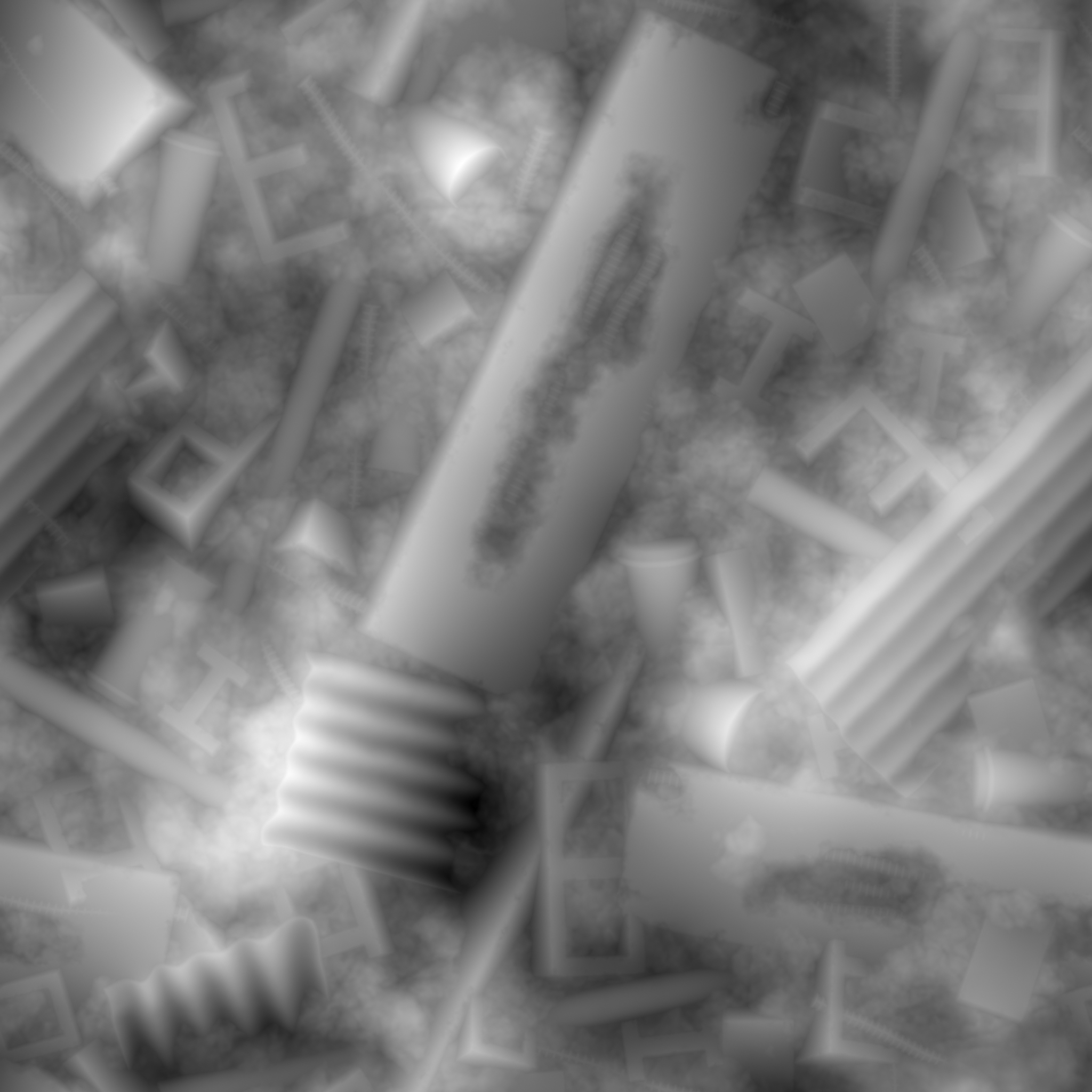
The Height maps within Knald are generated quickly and efficiently from Normal Maps provided by The Integrator, via photographs from our Color To Normals functionality and our world class baker.
Please see the Color To Normals & The Baker pages for more information.
All calculations & processing within Knald are performed in double/single precision floating point (float64/float32). We have painstakingly ensured that with our robust I/O pipeline, with full 8, 16 and 32bit (integer and float) support, you will never suffer from precision drop due to lazy or poor coding and can focus on creating great art!
You can preview your Heightmaps displaced on a primitive mesh, in real-time, with our 3D preview’s fast, efficient and scalable tessellation. There is no more need to go through complex workflows to get a Heightmap into your engine only to find that it doesn’t look the way you hoped.
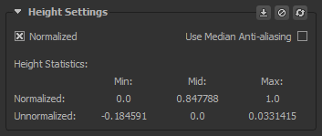
The following controls & information are only available from Height maps generated within The Baker.
Normalized: A choice of how the height map is scaled.
Use Median Anti-aliasing This check box is a toggle between Average & Median anti-aliasing & is only available from Height maps generated within The Baker.
Height Statistics: Various statistics for baked height map data.
Normalized:
Unnormalized: